oglala, 2010
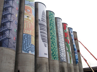
Commercially printed poly mesh banner; 80’ x 20’
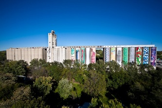
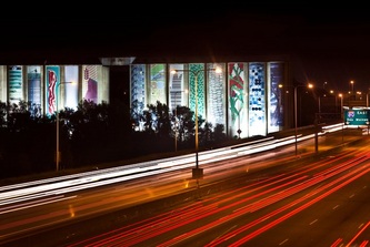
One of 13 banner designs selected for “Stored Potential:
Repurposing the Mid-Century Grain Elevator."
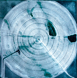
Inspired by the Stored Potential project description reference to “reading the landscape,” public artist Matthew Farley immediately envisioned center-pivot irrigation circles. An aerial reminder of the grid system imposed over much of the United States by Thomas Jefferson’s 1785 National Land Survey, the pattern still provides the basic geometric order of the once unruly Great Plains. In June 1976, Scientific American magazine called center pivot irrigation “perhaps the most significant mechanical innovation in agriculture since the replacement of draft animals by the tractor.” William E. Splinter, the author, then a professor of agricultural engineering at the University of Nebraska-Lincoln, though possibly biased, was not far off the mark. A short 25 years later, US astronauts could identify the Northeast Nebraska region from 270 miles in space by the patterns of lush, green crop circles produced by center pivots. When these circles began to fill the infrastructural grid of settlement, simple topographic potential became technological potential.
Using satellite imagery, Matthew has stitched together a “quilt” of parcels from the Nebraska landscape near the town of Ogallala so that the resulting arrangement of darkened crop circles emerge as Braille symbols. Coded within the crop circles is a reference to the Ogallala (High Plains) Aquifer, the precious resource stored below—perhaps the ultimate “stored potential.” The image’s pattern alludes to the originating word, “oglala” (lower case is used in the translation for visual purposes), meaning “to scatter one’s own.” The watery color palette offers a visual clue to this coded text—and certainly, the “circles of blue” are appropriate as well. The banner utilizes high-resolution satellite imagery courtesy of the United States Geological Survey that reveal details such as tractor tire marks, which form another layer of patterning reminiscent of quilting and an indication of deeper settlement: cultivation. Seemingly plucked straight from a satellite, this composed landscape, although fictitious, also affords the inclusion of I-80 and the Lower Platte River across the top of the banner and further integrates topography and technology.
Text by Matthew Dominic Farley and Anne Trumble


